Coast, lakes and northern distances. Learn Finland one place at a time.
Connect Turku, an inland town and a Helsinki-area island fortress. Build a Finnish map that reaches beyond a capital-city landmark and respects the country’s scale.
The sample needs no account. This guide is in English; game languages vary.
Actual Finland gameplay. No mock-up.
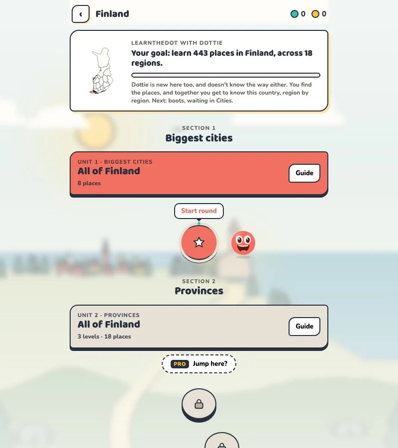
Your learning route
Coast/Lakeland/Lapland framework; Finnish and Swedish name variants
Finnish locality practice and region-based travel learning.
Short rounds. Immediate feedback.
The practice habit of Duolingo. The map challenge of GeoGuessr.
GuessTheDot brings those two ideas together: short, playful rounds that help you place real cities, villages and landmarks. One name, one map, immediate feedback.
What does each practice format offer?
Feature
GuessTheDotThe combination for geography
DuolingoLanguage lessons
GeoGuessrClassic
Short practice sessions
✓
✓
✓
Immediate answer feedback
✓
✓
✓
Geography map gameplay
✓
—
✓
Practise named cities and villages
✓
—
—
Infer locations from Street View
—
—
✓
Adaptive language lessons
—
✓
—
Free access and extras
Free demo and base game. Account for villages; Pro for extras.
Free language lessons; paid subscriptions for extras.
Limited free version; Pro for broader access.
On a small screen, scroll the table horizontally.
Practise cities and villages on the map.
Want to remember where a city or village is? Practise connecting its name to its location. Choose a country, start with big cities and build a more detailed mental map. GeoGuessr Classic suits discovering locations through street imagery; Duolingo suits practising languages.
About this comparison
The table compares Duolingo language lessons, GeoGuessr Classic and the current GuessTheDot map quiz. Other games or products from these companies are outside its scope. The combination describes the practice format; GuessTheDot does not offer an equivalent adaptive language curriculum or Street View game.
Guess the city. Guess the village. Place the landmark.
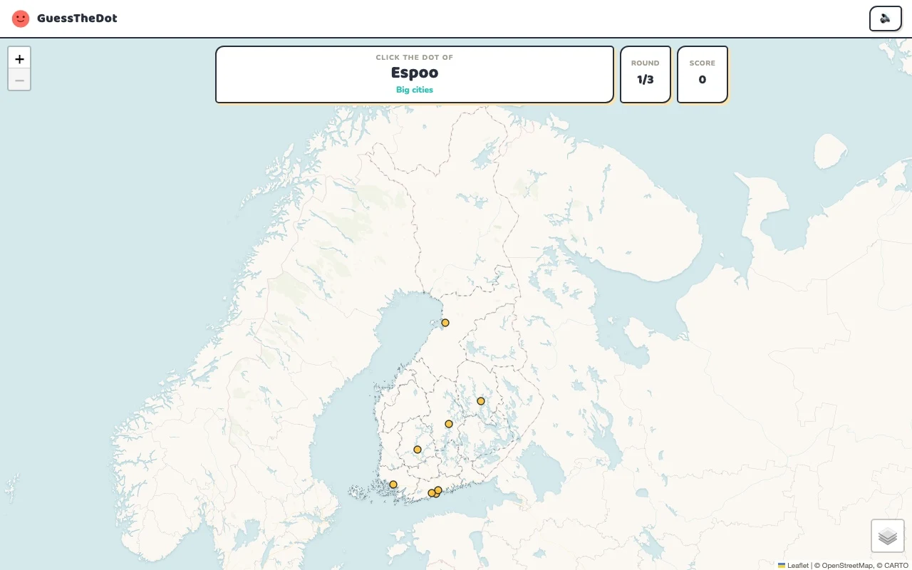
Three rounds. The real Finland game.
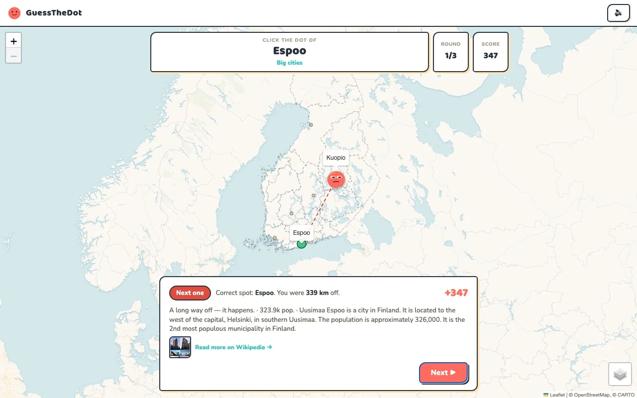
This is the actual GuessTheDot solo game, already set up for three big-city rounds in this country. Choose a map dot, see the real answer feedback and play the next round. Continue in the app when you want a full game.
Three rounds drawn from the country’s big-city dataset. No timer: take your time.
Play the real game3 rounds · no account
The actual map, dots and feedback. Preconfigured for three rounds.
The official tourism site distinguishes the Helsinki region, Lakeland, the Coast and Archipelago, and Lapland. Those are helpful mental areas, not a replacement for every administrative region label in the game. Turku provides a southwestern reference; Oulu extends the picture further north.
02
Keep a town connected to its surroundings
Lapua gives a question in South Ostrobothnia rather than another Helsinki-area suburb. Use the broader region, then look for the exact location. The source place data can contain differing kinds of settlements, so the guide lists describe what is playable rather than claim to enumerate every Finnish municipality.
03
Names and distances deserve care
A place may be familiar under a Finnish or Swedish name, while the current dataset shows one version. Match the location first, and do not infer that all variants are present. Suomenlinna provides a coastal anchor near Helsinki; a national map still needs separate northern references before it becomes useful for the whole country.
Existing in-game content
Start with places that anchor the map.
Uusimaa
Helsinki
A capital-area starting point.
60.169°, 24.936°
From the existing place guide
Helsinki (ruots. Helsingfors) on Suomen pääkaupunki ja Uudenmaan maakuntakeskus, joka sijaitsee Etelä-Suomessa Suomenlahden pohjoisrannalla.
Turku on Lounais-Suomen suurin kaupunki ja Varsinais-Suomen maakuntakeskus. Se sijaitsee Aurajoen suulla Saaristomeren rannikolla. Turun kaupungissa asuu noin 210 000 ja laajemmin koko seudulla noin 356 000 henkeä.
Lapua on Suomen kaupunki, joka sijaitsee Etelä-Pohjanmaan maakunnassa. Kaupungissa asuu 13 927 asukasta. Kunnan pinta-ala on 750,89 km², josta 13,62 km² on vesistöjä.
Suomenlinna, or Sveaborg, is a sea fortress composed of eight islands, of which six have been fortified. Located about four kilometres (2.5 mi) southeast of the city center of Helsinki, Finland, Suomenlinna is a popular destination for both tourists and locals, who enjoy it as a picturesque picnic site. Construction of the fortress began in 1748 under the Swedish Crown as a defense against Russia.
Lake Inari is the largest lake in Sápmi and the third-largest lake in Finland. It is located in the northern part of Lapland, north of the Arctic Circle. The lake is 117–119 metres (384–390 ft) above sea level, and is regulated at the Kaitakoski power plant in Russia. The freezing period normally extends from November to early June.
The Petäjävesi Old Church is a wooden church located in Petäjävesi, Finland. It was built between 1763 and 1765, when Tavastia was still a part of Sweden. The bell tower was built in 1821. It was inscribed in 1994 on the UNESCO World Heritage List for its testimony to the wooden church architecture of the Nordic countries. The church is located about 1 kilometre (0.62 mi) to the west of the centre of Petäjävesi.
Guide extracts retain their source wording and may use a different language. Wikipedia/Wikivoyage text is available under CC BY-SA; Wikidata factual data is CC0. Individual source links are above.
Real answer feedback from the same country practice session.
Choose your next practice
Make the map more detailed.
The current dataset contains 443 place records and 561 distinct sightseeing names. These are dataset counts, not a claim to cover every settlement or attraction.
Are both Finnish and Swedish names available everywhere?
No. Place-name coverage depends on the current dataset and translations. This page does not promise a complete bilingual register or a Finnish interface.