Place Lyon, a Normandy town and a royal palace on the same mental map. Practise French cities and villages through their regions, coasts and neighbouring places.
The sample needs no account. This guide is in English; game languages vary.
Actual France gameplay. No mock-up.
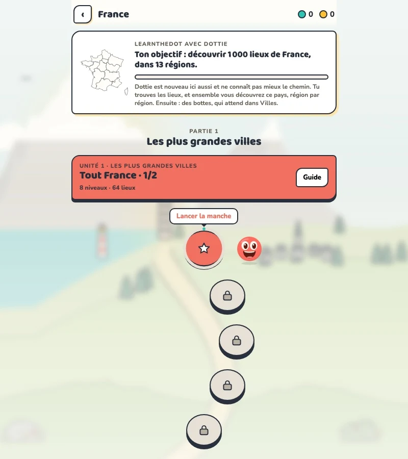
Your learning route
Regional geography beyond the Paris shortcut
French map revision and travellers preparing regional journeys.
Short rounds. Immediate feedback.
The practice habit of Duolingo. The map challenge of GeoGuessr.
GuessTheDot brings those two ideas together: short, playful rounds that help you place real cities, villages and landmarks. One name, one map, immediate feedback.
What does each practice format offer?
Feature
GuessTheDotThe combination for geography
DuolingoLanguage lessons
GeoGuessrClassic
Short practice sessions
✓
✓
✓
Immediate answer feedback
✓
✓
✓
Geography map gameplay
✓
—
✓
Practise named cities and villages
✓
—
—
Infer locations from Street View
—
—
✓
Adaptive language lessons
—
✓
—
Free access and extras
Free demo and base game. Account for villages; Pro for extras.
Free language lessons; paid subscriptions for extras.
Limited free version; Pro for broader access.
On a small screen, scroll the table horizontally.
Practise cities and villages on the map.
Want to remember where a city or village is? Practise connecting its name to its location. Choose a country, start with big cities and build a more detailed mental map. GeoGuessr Classic suits discovering locations through street imagery; Duolingo suits practising languages.
About this comparison
The table compares Duolingo language lessons, GeoGuessr Classic and the current GuessTheDot map quiz. Other games or products from these companies are outside its scope. The combination describes the practice format; GuessTheDot does not offer an equivalent adaptive language curriculum or Street View game.
Guess the city. Guess the village. Place the landmark.
Three rounds. The real France game.
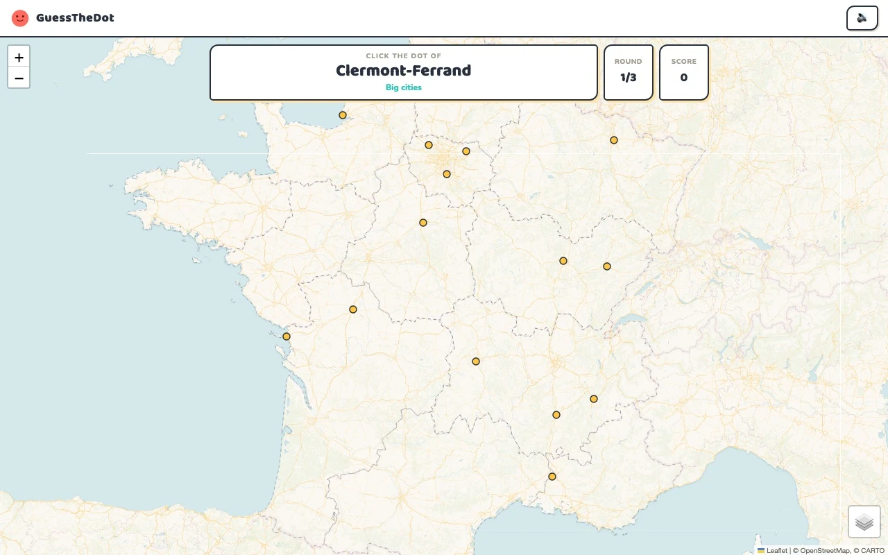
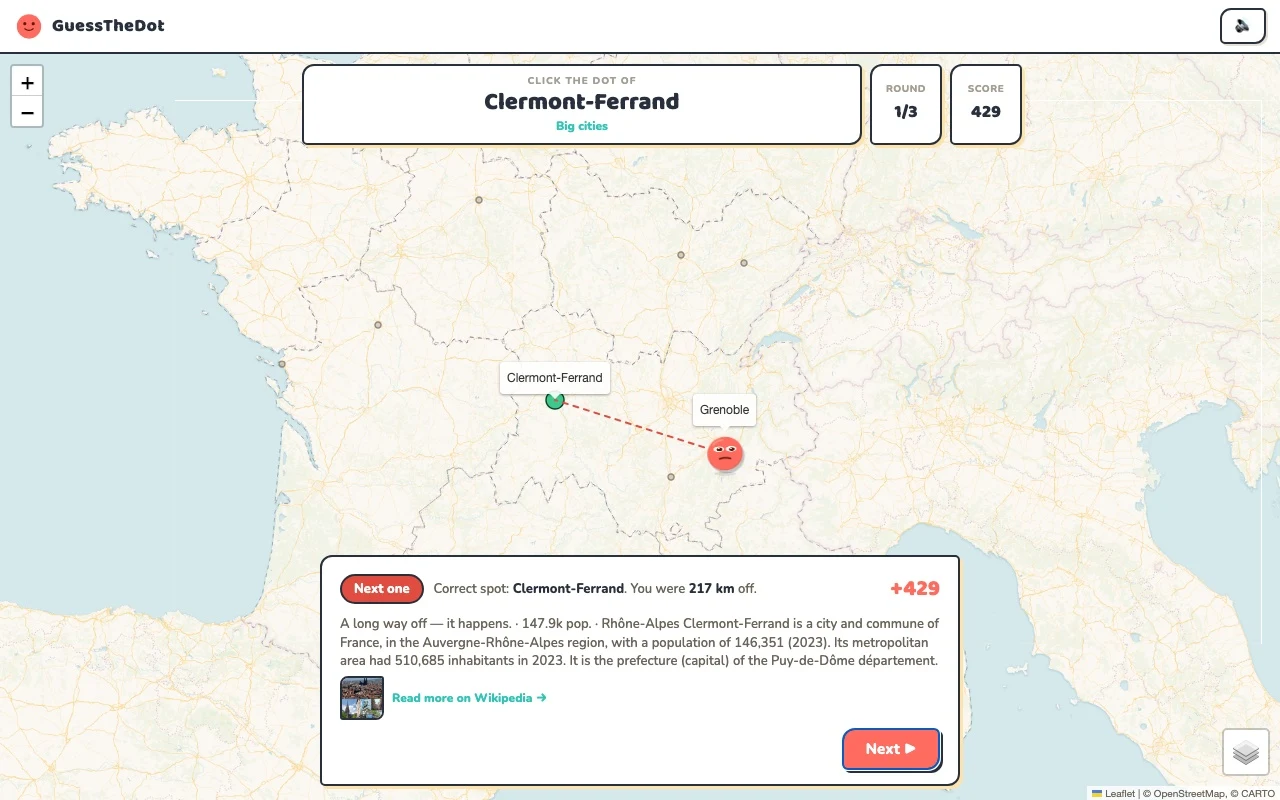
This is the actual GuessTheDot solo game, already set up for three big-city rounds in this country. Choose a map dot, see the real answer feedback and play the next round. Continue in the app when you want a full game.
Three rounds drawn from the country’s big-city dataset. No timer: take your time.
Play the real game3 rounds · no account
The actual map, dots and feedback. Preconfigured for three rounds.
Lyon, Marseille and Nantes give you different starting points. Learn their broad positions before you attempt the less familiar places around them. The game uses region labels from its place data, so a label can help you orient yourself without pretending that every historic province is the same as a modern administrative region.
02
Learn a coastal town in context
Ouistreham belongs to Normandy. Instead of memorising the name by itself, connect the town to the northern coast and then compare it with a southern place in another round. Short contrasts give a place a position in your mental map, even when you have never visited it.
03
Keep the mainland and overseas geography distinct
This introductory map uses metropolitan France. French overseas geography should not be squeezed into a misleading mainland map. The sightseeing data also contains a wider range of locations; the selected examples here are deliberately mainland sights. Use the actual category lists to see what a particular game can ask.
Existing in-game content
Start with places that anchor the map.
Île-de-France
Paris
Use the capital as one reference, not the whole map.
48.857°, 2.352°
From the existing place guide
Paris est la capitale de la France et le chef-lieu de la région Île-de-France. Elle est située au centre du Bassin parisien, sur une boucle de la Seine, entre les confluents avec la Marne et l'Oise.
The Palace of Versailles is a château and historic monument in Versailles in the Yvelines department of France, southwest of Paris. It served as the principal residence of the French kings Louis XIV, Louis XV, and Louis XVI. The king, the court, and the royal government lived there permanently from 6 May 1682 until 6 October 1789, except during the Regency years (1715–1723).
A recognisable starting point for the sightseeing mode.
48.858°, 2.295°
From the existing place guide
The Eiffel Tower (EYE-fəl) is a lattice tower on the Champ de Mars in Paris, France. It is named after the engineer Gustave Eiffel, whose company designed and built the tower from 1887 to 1889. Locally nicknamed "La dame de fer" (French for "Iron Lady") for its use of wrought iron, it was constructed as the centrepiece of the 1889 World's Fair, and to crown the centennial anniversary of the French Revolution.
Place a cultural landmark within its city context.
48.861°, 2.336°
From the existing place guide
The Louvre is a national art museum in Paris, France. It is located on the Right Bank of the Seine in the city's 1st arrondissement (district) and home to some of the most canonical works of Western art, including the Mona Lisa, Venus de Milo, and Winged Victory. The museum is housed in the Louvre Palace, originally built in the late 12th to 13th century under Philip II.
Guide extracts retain their source wording and may use a different language. Wikipedia/Wikivoyage text is available under CC BY-SA; Wikidata factual data is CC0. Individual source links are above.
Real answer feedback from the same country practice session.
Choose your next practice
Make the map more detailed.
The current dataset contains 5,408 place records and 1,119 distinct sightseeing names. These are dataset counts, not a claim to cover every settlement or attraction.
No. City and village categories cover places across the playable French dataset. The three-question sample is a mainland introduction; the guides show the complete category lists.