Mainland, islands, ancient places. Learn where Greece comes together.
Place Thessaloníki, Náfplio and Mount Olympus before exploring further. Learn the map behind Greek place names, not just the photographs of familiar ruins.
The sample needs no account. This guide is in English; game languages vary.
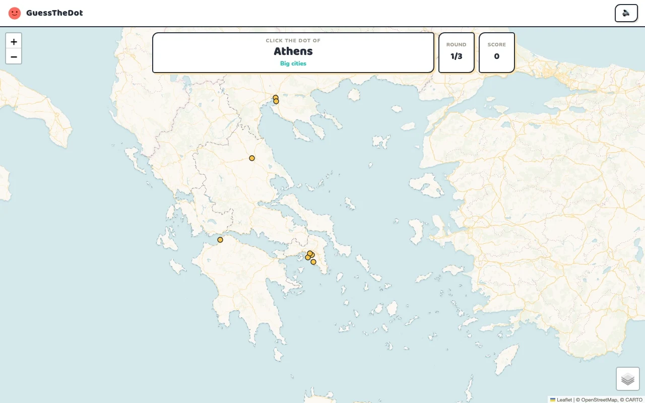
Actual Greece gameplay. No mock-up.
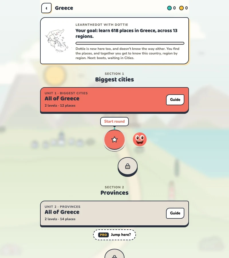
Your learning route
Mainland/island distinctions and Greek name variants
Greek map recognition and travellers connecting archaeological sights to regions.
Short rounds. Immediate feedback.
The practice habit of Duolingo. The map challenge of GeoGuessr.
GuessTheDot brings those two ideas together: short, playful rounds that help you place real cities, villages and landmarks. One name, one map, immediate feedback.
What does each practice format offer?
Feature
GuessTheDotThe combination for geography
DuolingoLanguage lessons
GeoGuessrClassic
Short practice sessions
✓
✓
✓
Immediate answer feedback
✓
✓
✓
Geography map gameplay
✓
—
✓
Practise named cities and villages
✓
—
—
Infer locations from Street View
—
—
✓
Adaptive language lessons
—
✓
—
Free access and extras
Free demo and base game. Account for villages; Pro for extras.
Free language lessons; paid subscriptions for extras.
Limited free version; Pro for broader access.
On a small screen, scroll the table horizontally.
Practise cities and villages on the map.
Want to remember where a city or village is? Practise connecting its name to its location. Choose a country, start with big cities and build a more detailed mental map. GeoGuessr Classic suits discovering locations through street imagery; Duolingo suits practising languages.
About this comparison
The table compares Duolingo language lessons, GeoGuessr Classic and the current GuessTheDot map quiz. Other games or products from these companies are outside its scope. The combination describes the practice format; GuessTheDot does not offer an equivalent adaptive language curriculum or Street View game.
Guess the city. Guess the village. Place the landmark.
Three rounds. The real Greece game.
This is the actual GuessTheDot solo game, already set up for three big-city rounds in this country. Choose a map dot, see the real answer feedback and play the next round. Continue in the app when you want a full game.
Three rounds drawn from the country’s big-city dataset. No timer: take your time.
Play the real game3 rounds · no account
The actual map, dots and feedback. Preconfigured for three rounds.
Athens and Thessaloníki give you a clear contrast, but a smaller place such as Náfplio needs a more precise connection to the Peloponnese. Start with the broad mainland area, then locate the dot. Learning an island name is a separate scale of task, not the same thing as knowing which village on that island is being asked.
02
A transliteration is a bridge, not a new locality
Greek names in the game can appear in Latin transliteration, sometimes with accents. Connect Náfplio or Thessaloníki to the location you recognise instead of treating each spelling as a different destination. This English page does not claim to provide a full Greek-language interface or every Greek spelling variant.
03
Use living map references alongside ancient sites
Mount Olympus provides a natural anchor; the Parthenon belongs to Athens. A famous ancient name alone can be a poor map clue if its location or historical context is ignored. The selected sights here are contemporary geographical references, and each record links to its source instead of suggesting that every ancient monument survives intact.
Existing in-game content
Start with places that anchor the map.
Attica
Athens
A capital anchor on the mainland.
37.984°, 23.728°
From the existing place guide
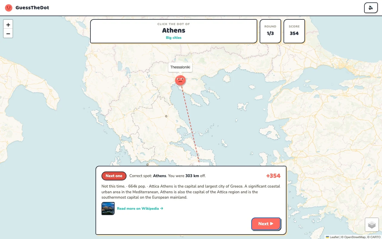
Athens is the capital and largest city of Greece. A significant coastal urban area in the Mediterranean, Athens is also the capital of the Attica region and is the southernmost capital on the European mainland.
Nafplio or Nafplion (Greek: Ναύπλιο, romanized: Náfplio) is a coastal city located in the Peloponnese in Greece. It is the capital of the regional unit of Argolis and an important tourist destination.
Mount Olympus (romanized: Ólympos) is an extensive massif near the Thermaic Gulf of the Aegean Sea, in Greece, located on the border between Thessaly and Macedonia, between the regional units of Larissa and Pieria, about 80 km (50 mi) southwest from Thessaloniki. Mount Olympus has 52 peaks and deep gorges.
The Parthenon (romanised: Parthenōn [par.tʰe.nɔ̌ːn], romanised: Parthenónas [parθeˈnonas]) is a former temple on the Athenian Acropolis, Greece, that was dedicated to the goddess Athena. Its decorative sculptures are considered some of the high points of classical Greek art, and the Parthenon is considered an enduring symbol of ancient Greece, Western civilisation, and democracy.
An island context distinct from the mainland sample.
39.624°, 19.920°
From the existing place guide
Corfu ( kor-FOO, -FEW, US also KOR-foo, -few) or Kerkyra (Greek: Κέρκυρα, romanized: Kérkyra, pronounced [ˈcercira] ) is one of the Ionian Islands in western Greece, and the northernmost island on Greece's west coast except for its satellite Diapontian Islands, which are also the westernmost point of all Greece.
Guide extracts retain their source wording and may use a different language. Wikipedia/Wikivoyage text is available under CC BY-SA; Wikidata factual data is CC0. Individual source links are above.
Real answer feedback from the same country practice session.
Choose your next practice
Make the map more detailed.
The current dataset contains 618 place records and 854 distinct sightseeing names. These are dataset counts, not a claim to cover every settlement or attraction.
No. These three questions introduce mainland anchors. The country guides and sightseeing data show the available island places; use a regional game for closer practice.