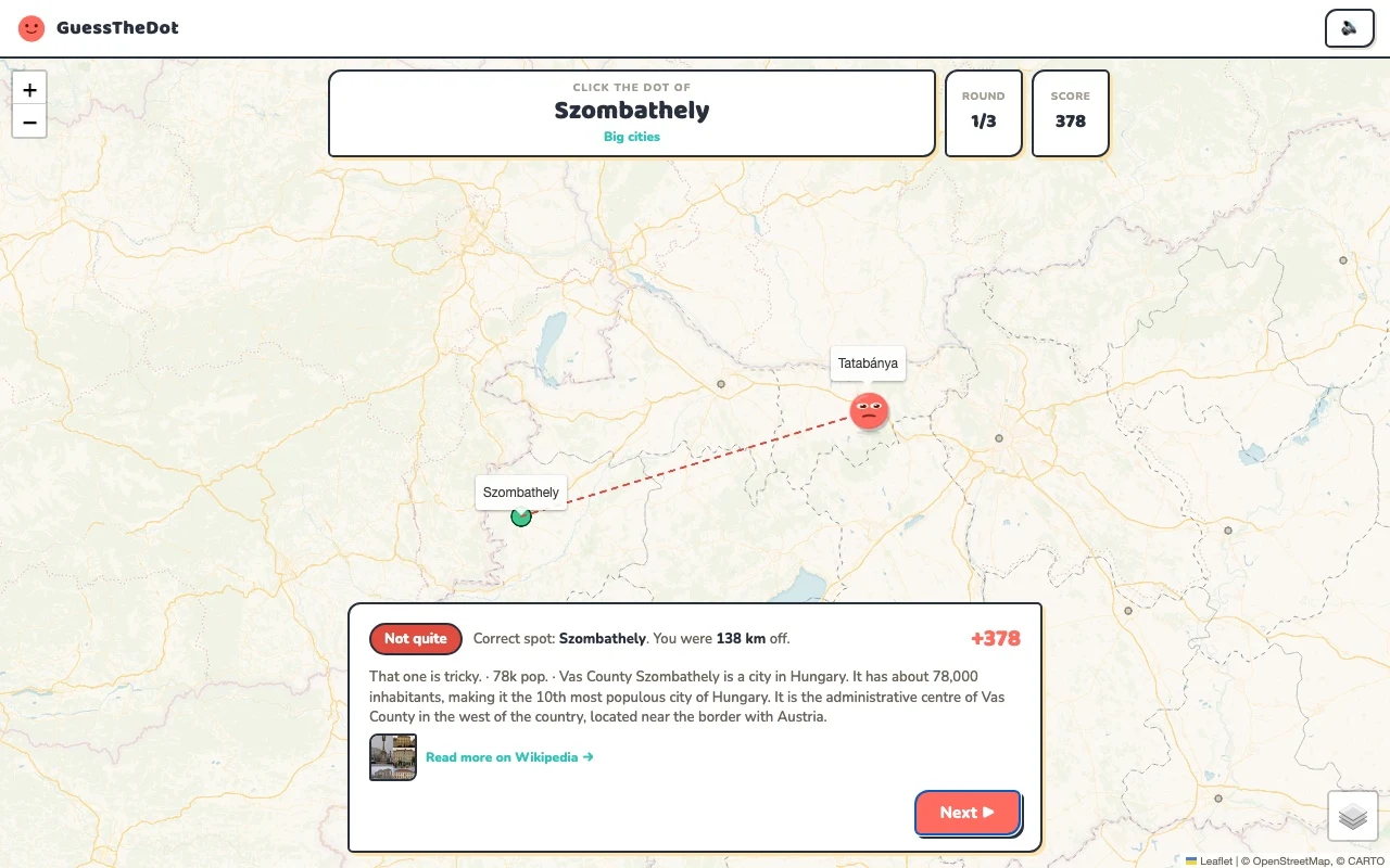
The sample needs no account. This guide is in English; game languages vary.
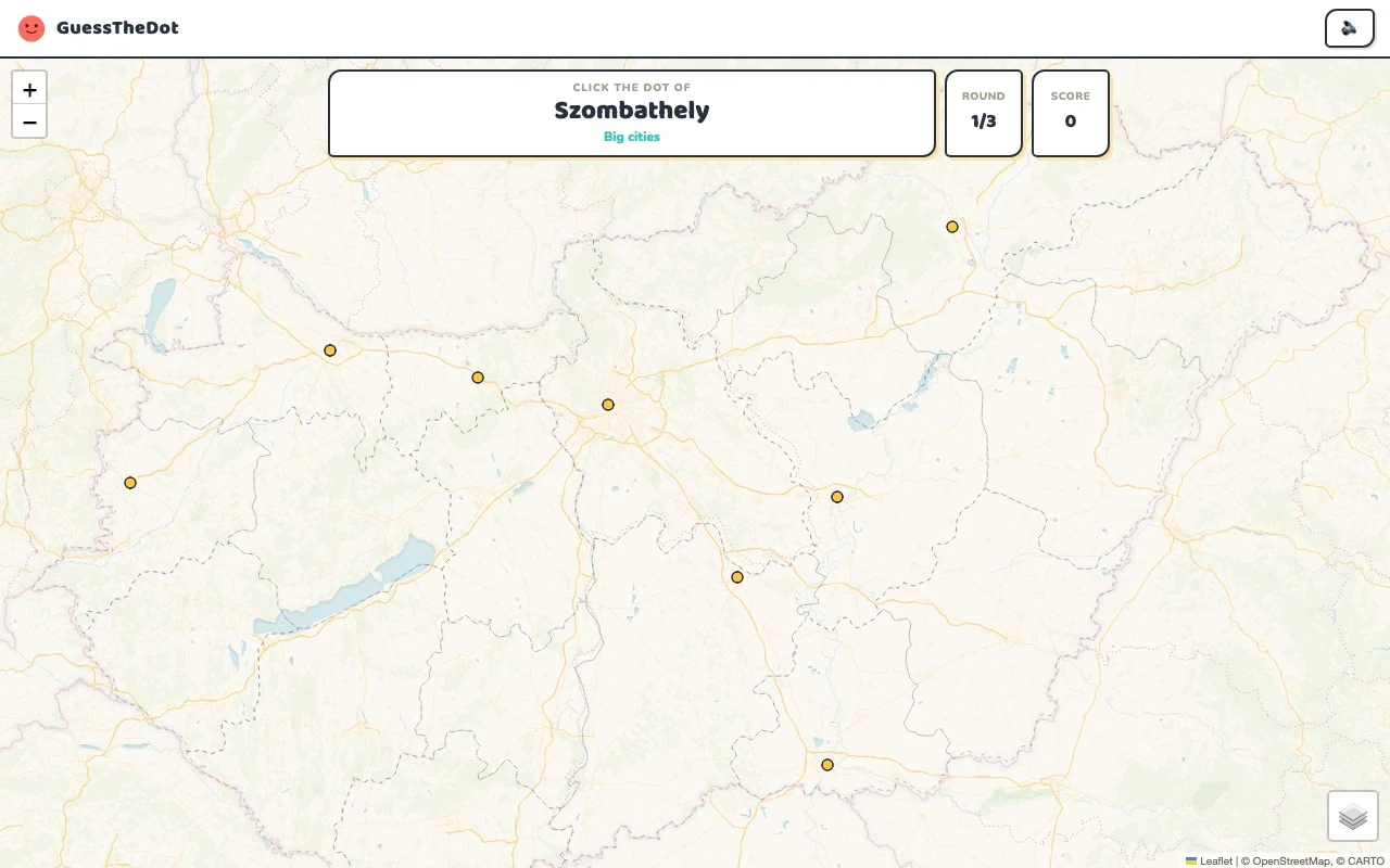
Actual Hungary gameplay. No mock-up.
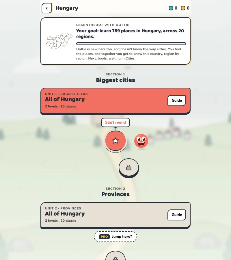
Your learning route
Danube, Balaton and regional towns beyond Budapest
Hungarian locality practice and destination-based learning.
Short rounds. Immediate feedback.
The practice habit of Duolingo. The map challenge of GeoGuessr.
GuessTheDot brings those two ideas together: short, playful rounds that help you place real cities, villages and landmarks. One name, one map, immediate feedback.
What does each practice format offer?
Feature
GuessTheDotThe combination for geography
DuolingoLanguage lessons
GeoGuessrClassic
Short practice sessions
✓
✓
✓
Immediate answer feedback
✓
✓
✓
Geography map gameplay
✓
—
✓
Practise named cities and villages
✓
—
—
Infer locations from Street View
—
—
✓
Adaptive language lessons
—
✓
—
Free access and extras
Free demo and base game. Account for villages; Pro for extras.
Free language lessons; paid subscriptions for extras.
Limited free version; Pro for broader access.
On a small screen, scroll the table horizontally.
Practise cities and villages on the map.
Want to remember where a city or village is? Practise connecting its name to its location. Choose a country, start with big cities and build a more detailed mental map. GeoGuessr Classic suits discovering locations through street imagery; Duolingo suits practising languages.
About this comparison
The table compares Duolingo language lessons, GeoGuessr Classic and the current GuessTheDot map quiz. Other games or products from these companies are outside its scope. The combination describes the practice format; GuessTheDot does not offer an equivalent adaptive language curriculum or Street View game.
Guess the city. Guess the village. Place the landmark.
Three rounds. The real Hungary game.
This is the actual GuessTheDot solo game, already set up for three big-city rounds in this country. Choose a map dot, see the real answer feedback and play the next round. Continue in the app when you want a full game.
Three rounds drawn from the country’s big-city dataset. No timer: take your time.
Play the real game3 rounds · no account
The actual map, dots and feedback. Preconfigured for three rounds.
Budapest is a useful starting anchor, but Szeged, Debrecen and Pécs occupy different positions. Compare two places before choosing the dot so that the country becomes a set of relationships. A familiar capital can help you orient yourself; it should not become the answer to every sightseeing question.
02
Treat the smaller települések as real map work
Ráckeve introduces a more local question in the Pest-area data. Match the location, not just the similarity of a name or its accent marks. County names in stored records can lag administrative naming changes, so these labels support the quiz rather than act as a current official administrative register.
03
Make the lake a geographical reference
Lake Balaton gives the map a memorable natural anchor. Contrast it with Hortobágy National Park and a Budapest landmark such as Buda Castle. The official tourism site organises destinations around several different areas; sightseeing practice helps you connect those destination names to actual positions.
Existing in-game content
Start with places that anchor the map.
Budapest
Budapest
Begin with a capital-area reference.
47.498°, 19.041°
From the existing place guide
Budapest Magyarország fővárosa (1892-1949 között a hivatalos megnevezése: ‘székesfőváros’), egyben legnagyobb és legnépesebb települése, jelenleg az Európai Unió 8.
Szeged is the third largest city of Hungary, the largest city and regional centre of the Southern Great Plain and the county seat of Csongrád-Csanád county.
Ráckeve város a Csepel-sziget déli részén, a Ráckevei-Duna mentén, Pest vármegye Ráckevei járásában, melynek a székhelye. A múltban is rendelkezett már városi ranggal, de azt valamikor a 19.
Lake Balaton is a freshwater rift lake in the Transdanubian region of Hungary. It is the largest lake in Central Europe, and one of the region's foremost tourist destinations. The Zala River provides the largest inflow of water to the lake, and the canalized Sió is the only outflow. The mountainous region of the northern shore is known both for its historic character and as a major wine region, while the flat southern shore is known for its resort towns.
Buda Castle, formerly also called the Royal Palace and the Royal Castle, is the historical castle and palace complex of the Hungarian kings in Budapest. First completed in 1265, the Baroque palace that occupies most of the site today was built between 1749 and 1769, severely damaged during the Siege of Budapest in World War II, and rebuilt in a simplified Baroque style during the state communist era.
Hortobágy is an 800 km2 national park in eastern Hungary. The park, a part of the Alföld (Great Plain), was designated as a national park in 1973 (the first in Hungary), and elected among the World Heritage Sites in 1999. The Hortobágy is Hungary's largest protected area, and the largest semi-natural grassland in Europe.
Guide extracts retain their source wording and may use a different language. Wikipedia/Wikivoyage text is available under CC BY-SA; Wikidata factual data is CC0. Individual source links are above.
Real answer feedback from the same country practice session.
Choose your next practice
Make the map more detailed.
The current dataset contains 789 place records and 239 distinct sightseeing names. These are dataset counts, not a claim to cover every settlement or attraction.
Are all county labels guaranteed to use the latest official names?
No. The quiz displays the region labels in its stored place data. These need local review where names have changed; the geographic question is about the place location.