Baltic cities to southern towns. Put Poland on your map.
Learn Poland through its regions and places: a city on the Baltic coast, a smaller Pomeranian town and a castle that becomes a memorable reference point.
The sample needs no account. This guide is in English; game languages vary.
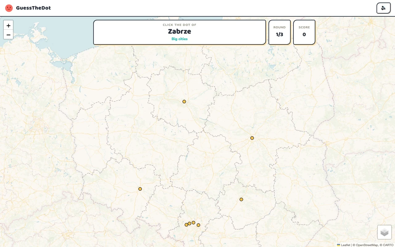
Actual Poland gameplay. No mock-up.
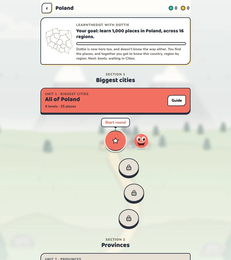
Your learning route
Voivodeships, diacritics and a coast-to-mountains framework
Learners connecting województwa to cities and smaller places.
Short rounds. Immediate feedback.
The practice habit of Duolingo. The map challenge of GeoGuessr.
GuessTheDot brings those two ideas together: short, playful rounds that help you place real cities, villages and landmarks. One name, one map, immediate feedback.
What does each practice format offer?
Feature
GuessTheDotThe combination for geography
DuolingoLanguage lessons
GeoGuessrClassic
Short practice sessions
✓
✓
✓
Immediate answer feedback
✓
✓
✓
Geography map gameplay
✓
—
✓
Practise named cities and villages
✓
—
—
Infer locations from Street View
—
—
✓
Adaptive language lessons
—
✓
—
Free access and extras
Free demo and base game. Account for villages; Pro for extras.
Free language lessons; paid subscriptions for extras.
Limited free version; Pro for broader access.
On a small screen, scroll the table horizontally.
Practise cities and villages on the map.
Want to remember where a city or village is? Practise connecting its name to its location. Choose a country, start with big cities and build a more detailed mental map. GeoGuessr Classic suits discovering locations through street imagery; Duolingo suits practising languages.
About this comparison
The table compares Duolingo language lessons, GeoGuessr Classic and the current GuessTheDot map quiz. Other games or products from these companies are outside its scope. The combination describes the practice format; GuessTheDot does not offer an equivalent adaptive language curriculum or Street View game.
Guess the city. Guess the village. Place the landmark.
Three rounds. The real Poland game.
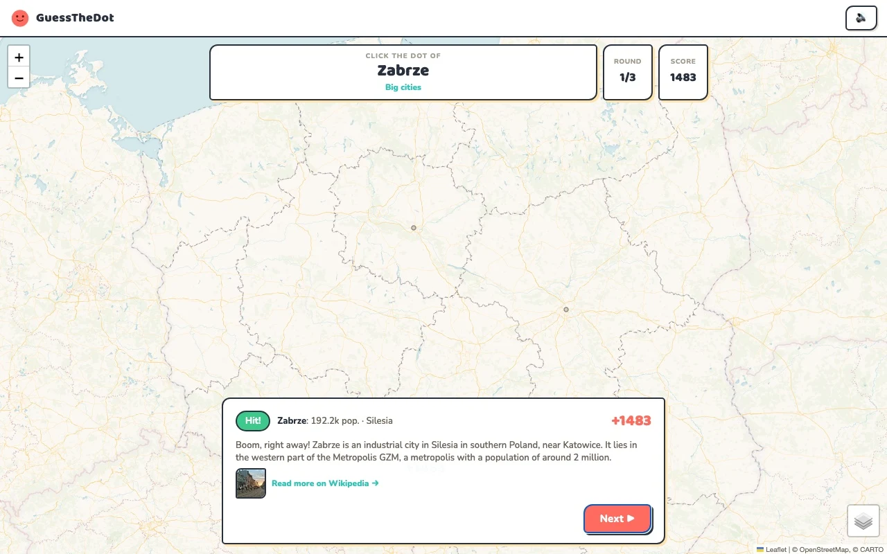
This is the actual GuessTheDot solo game, already set up for three big-city rounds in this country. Choose a map dot, see the real answer feedback and play the next round. Continue in the app when you want a full game.
Three rounds drawn from the country’s big-city dataset. No timer: take your time.
Play the real game3 rounds · no account
The actual map, dots and feedback. Preconfigured for three rounds.
Gdańsk is a coastal anchor; Kraków gives you a southern one. Warsaw belongs in a different part of the picture. Learn these contrasts before adding smaller towns. The Polish tourism board also organises its map around sixteen regions, making regional context a useful bridge from a familiar city to a less familiar locality.
02
Do not lose the Polish spelling
Gdańsk, Łódź and Wrocław are names to recognise, not spelling obstacles to remove. The source dataset keeps diacritics where it has them, while some English names remain. Your task is spatial: connect the name to a region and then a location, rather than assuming an unfamiliar letter means an unfamiliar part of the country.
03
Make a castle more than a picture
Malbork Castle is a useful northern reference. Compare it with Bytów and Gdańsk, but do not conclude that all three share the same position because they belong to the same broad region. The sample deliberately asks you to look closely within Pomerania instead of relying on a north-versus-south shortcut.
Existing in-game content
Start with places that anchor the map.
Mazovia
Warsaw
A capital-city anchor away from the Baltic coast.
52.230°, 21.012°
From the existing place guide
Warsaw, officially the Capital City of Warsaw, is the capital and most populous city of Poland. The metropolis stands on the river Vistula in east-central Poland.
Gdańsk – miasto na prawach powiatu w północnej Polsce w województwie pomorskim, położone nad Morzem Bałtyckim u ujścia Motławy do Wisły nad Zatoką Gdańską.
The Castle of the Teutonic Order in Malbork, commonly known as Malbork Castle, is a Brick Gothic castle complex located in the town of Malbork, Poland, built in the 13th and significantly expanded in the 14th century. It is the largest castle in the world measured by land area and a UNESCO World Heritage Site.
Białowieża Forest is a large forest complex and World Heritage Area straddling the border between Poland and Belarus. It is one of the last and the largest remaining parts of the immense primeval forest that once stretched across the European Plain. The forest is home to more than 800 European bison, Europe's heaviest land animal. The forest has been designated a UNESCO World Heritage Site and an EU Natura 2000 Special Area of Conservation.
Contrast the southern mountain setting with the coast.
49.179°, 20.088°
From the existing place guide
Rysy is a mountain in the crest of the High Tatras, eastern part of the Tatra Mountains, located on the border between Poland and Slovakia. Rysy has three summits: the middle at 2,501 m (8,205 ft); the north-western at 2,500 m (8,202 ft); and the south-eastern at 2,473 m (8,114 ft). The north-western summit is the highest point of Poland and belongs to the Crown of Polish Mountains; the other two summits are on the Slovak side of the border.
Guide extracts retain their source wording and may use a different language. Wikipedia/Wikivoyage text is available under CC BY-SA; Wikidata factual data is CC0. Individual source links are above.
Real answer feedback from the same country practice session.
Choose your next practice
Make the map more detailed.
The current dataset contains 1,538 place records and 821 distinct sightseeing names. These are dataset counts, not a claim to cover every settlement or attraction.
Does the game replace a Polish school map syllabus?
It is a practice tool with its own place dataset. A teacher can choose topics and homework sets, but this page does not claim alignment with a particular Polish curriculum.