From southern cities to smaller orter. Learn Sweden by location.
Build a Swedish map through cities, lakes and local places. Go beyond Stockholm by connecting Uppsala, Arvika and landmarks to their own parts of the country.
The sample needs no account. This guide is in English; game languages vary.
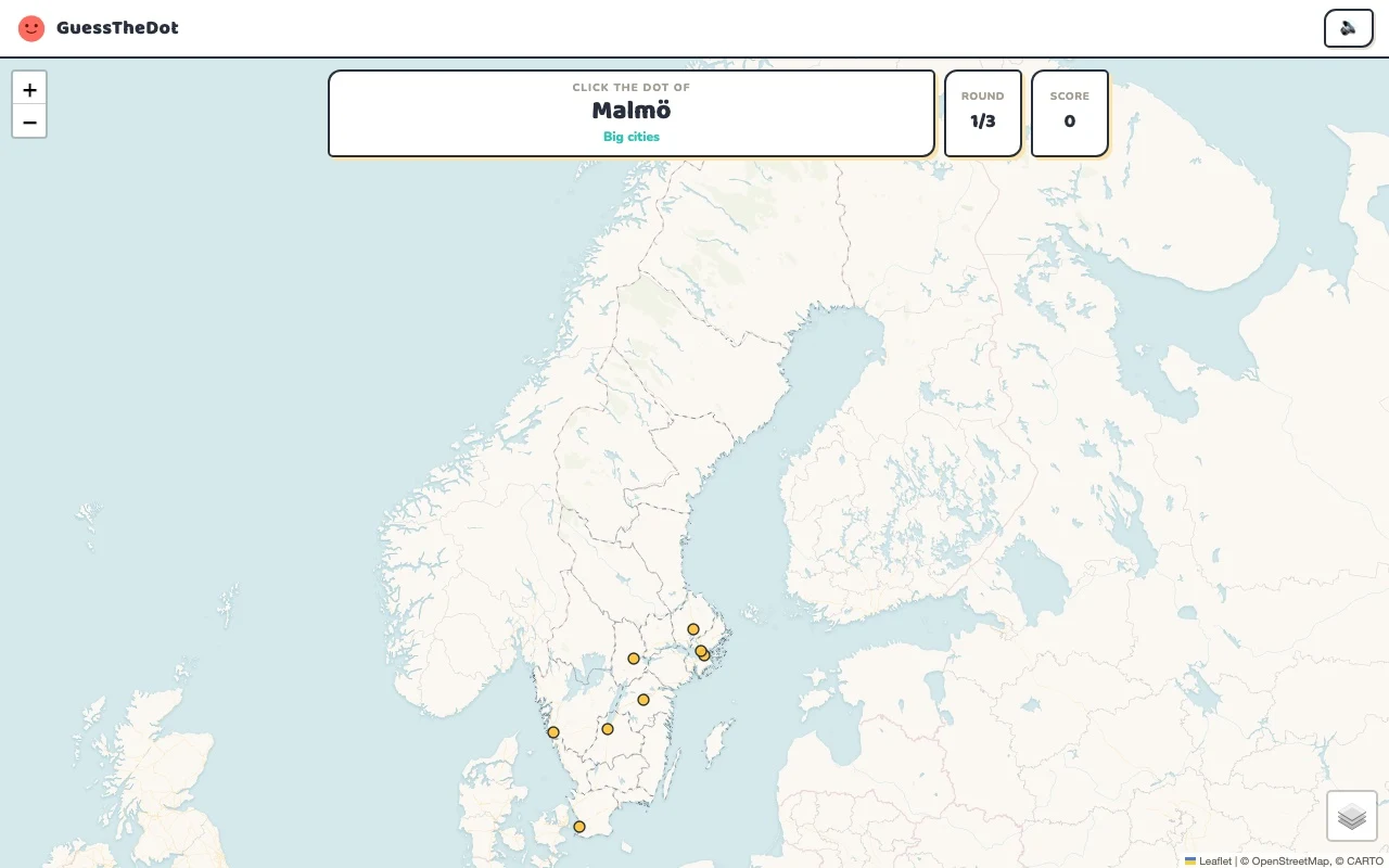
Actual Sweden gameplay. No mock-up.
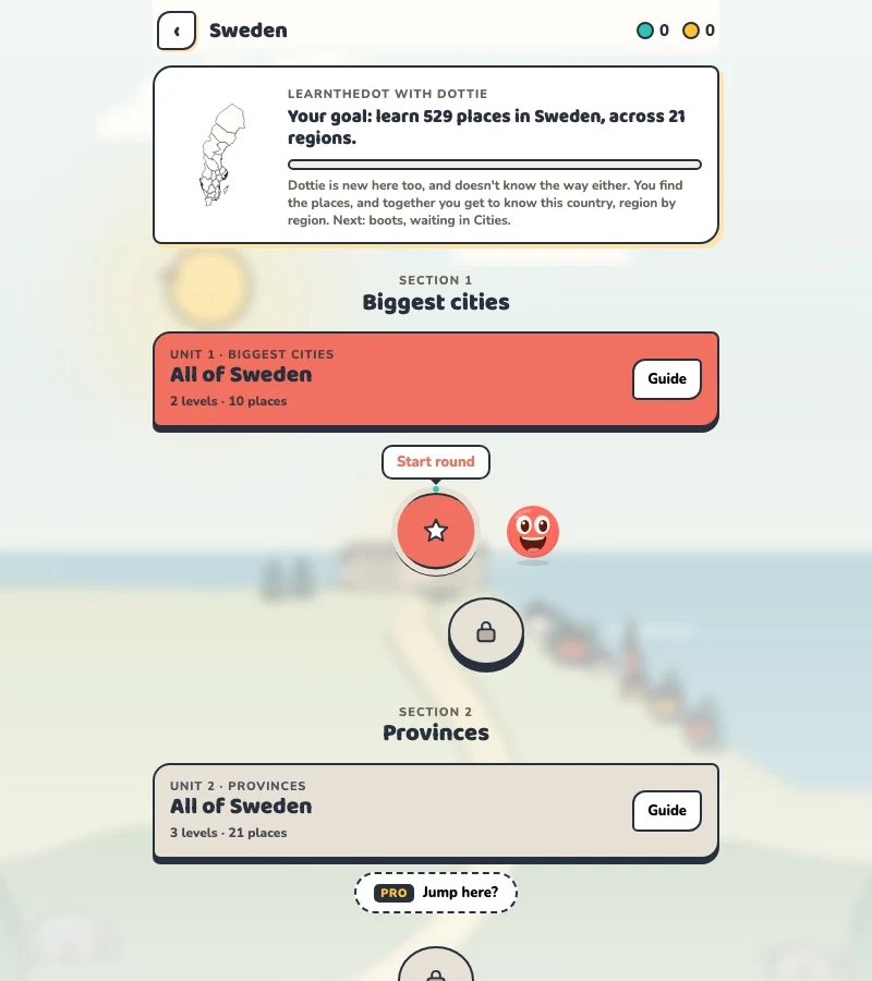
Your learning route
Long north-south distances; län versus historical landskap
Swedish locality recognition and region-based travel practice.
Short rounds. Immediate feedback.
The practice habit of Duolingo. The map challenge of GeoGuessr.
GuessTheDot brings those two ideas together: short, playful rounds that help you place real cities, villages and landmarks. One name, one map, immediate feedback.
What does each practice format offer?
Feature
GuessTheDotThe combination for geography
DuolingoLanguage lessons
GeoGuessrClassic
Short practice sessions
✓
✓
✓
Immediate answer feedback
✓
✓
✓
Geography map gameplay
✓
—
✓
Practise named cities and villages
✓
—
—
Infer locations from Street View
—
—
✓
Adaptive language lessons
—
✓
—
Free access and extras
Free demo and base game. Account for villages; Pro for extras.
Free language lessons; paid subscriptions for extras.
Limited free version; Pro for broader access.
On a small screen, scroll the table horizontally.
Practise cities and villages on the map.
Want to remember where a city or village is? Practise connecting its name to its location. Choose a country, start with big cities and build a more detailed mental map. GeoGuessr Classic suits discovering locations through street imagery; Duolingo suits practising languages.
About this comparison
The table compares Duolingo language lessons, GeoGuessr Classic and the current GuessTheDot map quiz. Other games or products from these companies are outside its scope. The combination describes the practice format; GuessTheDot does not offer an equivalent adaptive language curriculum or Street View game.
Guess the city. Guess the village. Place the landmark.
Three rounds. The real Sweden game.
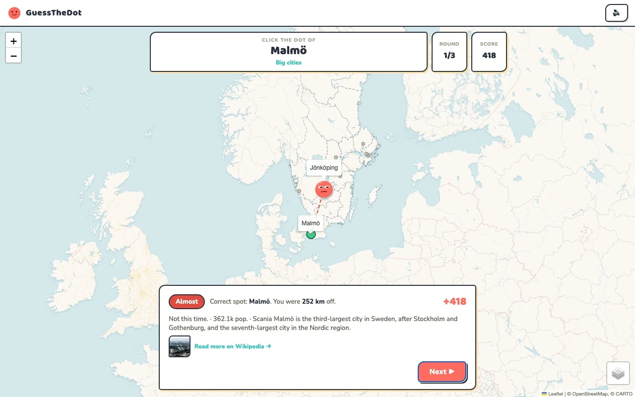
This is the actual GuessTheDot solo game, already set up for three big-city rounds in this country. Choose a map dot, see the real answer feedback and play the next round. Continue in the app when you want a full game.
Three rounds drawn from the country’s big-city dataset. No timer: take your time.
Play the real game3 rounds · no account
The actual map, dots and feedback. Preconfigured for three rounds.
Stockholm, Gothenburg and Malmö are useful anchors, but they leave much of Sweden unexplored. Before choosing a dot, notice whether the question belongs to the south, the middle or a much more northerly part of the map. A national view helps orientation; a tighter regional round can be better for distinguishing nearby places.
02
A county is not always a historic province
The game’s region labels follow its data and can be different from the landskap names a learner knows. Arvika in Värmland provides a concrete local example. Use the label as a clue and check the position, rather than assuming every regional name is a legal or cultural synonym.
03
Let lakes and sights organise the map
Vänern is a useful natural reference, while Drottningholm Palace belongs to the Stockholm context. Sightseeing practice can link those names to locations without asking you to identify a road sign first. The sample includes a capital-area landmark and more distant places so the map is not reduced to one city.
Existing in-game content
Start with places that anchor the map.
Stockholm
Stockholm
Begin with a capital-area reference.
59.329°, 18.069°
From the existing place guide
Stockholm är Sveriges huvudstad och största stad samt landets kulturella, politiska, mediala och ekonomiska centrum.
Drottningholm Palace is a royal palace in Drottningholm, on the island of Lovön in Ekerö Municipality, Stockholm County, Sweden. Built beginning in 1662, it served as a regular summer residence of the Swedish royal court during much of the 18th century and is today the residence of the Swedish royal family. The palace is part of the Royal Domain of Drottningholm, which was inscribed on the UNESCO World Heritage List in 1991 under criterion (iv).
Vänern (VAY-nərn, US also VEN-ərn) is the largest lake in Sweden, the largest lake in the European Union and the third-largest lake in Europe after Ladoga and Onega in Russia. It is located in the provinces of Västergötland, Dalsland, and Värmland in the southwest of the country.
A northern reference beyond the southern city map.
67.883°, 18.550°
From the existing place guide
Kebnekaise (from Sami Giebmegáisi or Giebnegáisi, "Cauldron Crest") is the highest mountain in Sweden. The Kebnekaise massif, which is part of the Scandinavian mountain range, has two main peaks. The glaciated southern peak used to be the highest at 2,120 metres (6,960 ft) above sea level, but has shrunk by 24 meters during the last 50 years, making the northern icefree peak at 2,096.8 metres (6,879 ft) the highest.
Guide extracts retain their source wording and may use a different language. Wikipedia/Wikivoyage text is available under CC BY-SA; Wikidata factual data is CC0. Individual source links are above.
Real answer feedback from the same country practice session.
Choose your next practice
Make the map more detailed.
The current dataset contains 529 place records and 694 distinct sightseeing names. These are dataset counts, not a claim to cover every settlement or attraction.
Can I practise Swedish localities rather than only major cities?
Yes. The category guides show the smaller places included in the playable dataset. They are not a complete register of every Swedish tätort or locality.