Go beyond Madrid and Barcelona. Find inland towns, connect Andalusian sights to their cities and build a clearer picture of Spain before your next quiz or journey.
The sample needs no account. This guide is in English; game languages vary.
Actual Spain gameplay. No mock-up.
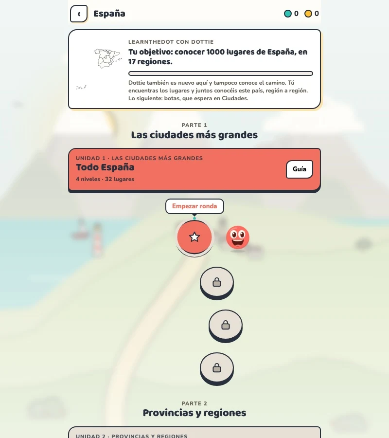
Your learning route
Autonomous communities and mainland/island separation
Spanish regional practice and travel beyond major coastal cities.
Short rounds. Immediate feedback.
The practice habit of Duolingo. The map challenge of GeoGuessr.
GuessTheDot brings those two ideas together: short, playful rounds that help you place real cities, villages and landmarks. One name, one map, immediate feedback.
What does each practice format offer?
Feature
GuessTheDotThe combination for geography
DuolingoLanguage lessons
GeoGuessrClassic
Short practice sessions
✓
✓
✓
Immediate answer feedback
✓
✓
✓
Geography map gameplay
✓
—
✓
Practise named cities and villages
✓
—
—
Infer locations from Street View
—
—
✓
Adaptive language lessons
—
✓
—
Free access and extras
Free demo and base game. Account for villages; Pro for extras.
Free language lessons; paid subscriptions for extras.
Limited free version; Pro for broader access.
On a small screen, scroll the table horizontally.
Practise cities and villages on the map.
Want to remember where a city or village is? Practise connecting its name to its location. Choose a country, start with big cities and build a more detailed mental map. GeoGuessr Classic suits discovering locations through street imagery; Duolingo suits practising languages.
About this comparison
The table compares Duolingo language lessons, GeoGuessr Classic and the current GuessTheDot map quiz. Other games or products from these companies are outside its scope. The combination describes the practice format; GuessTheDot does not offer an equivalent adaptive language curriculum or Street View game.
Guess the city. Guess the village. Place the landmark.
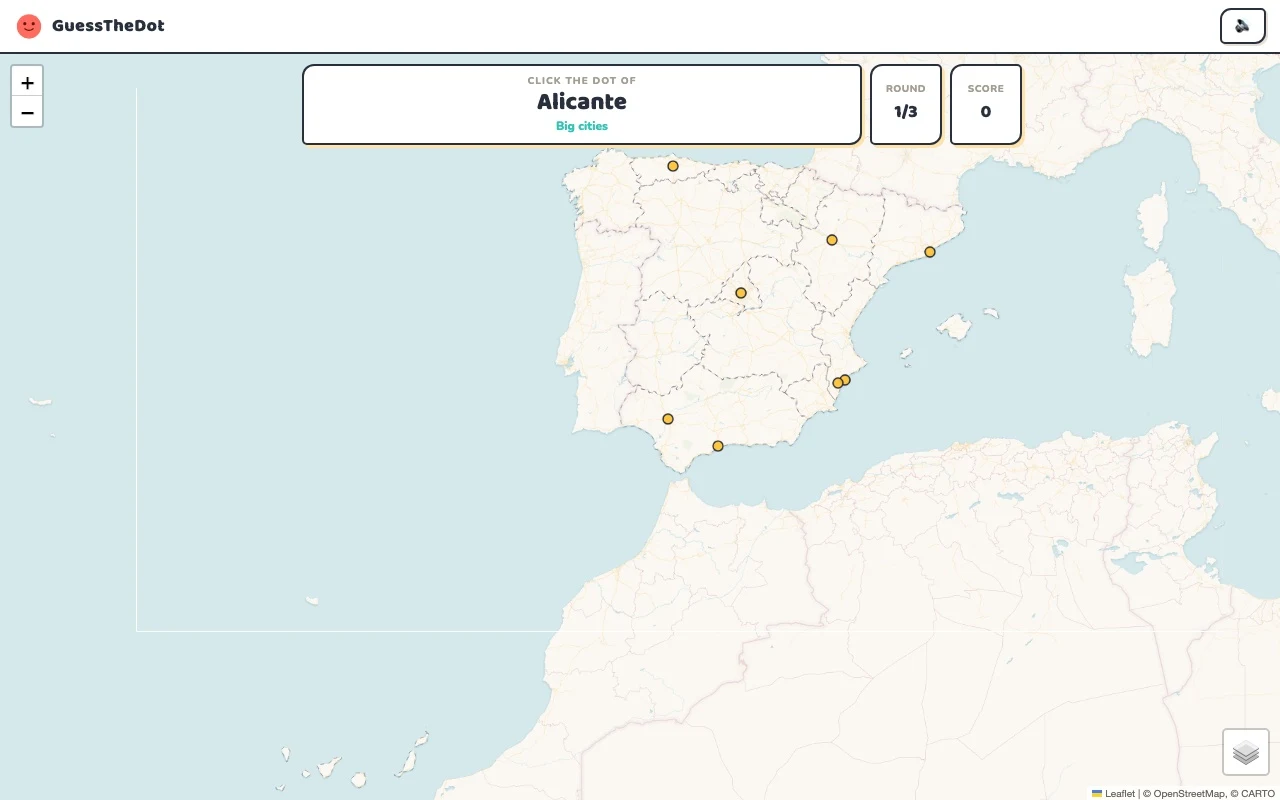
Three rounds. The real Spain game.
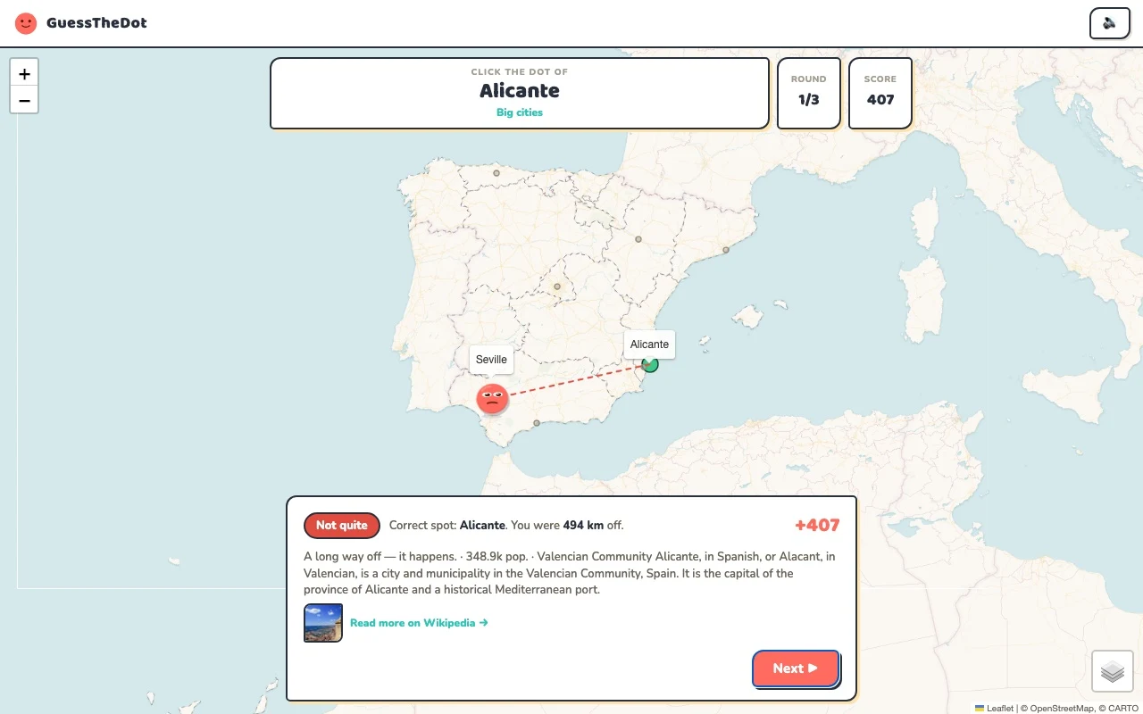
This is the actual GuessTheDot solo game, already set up for three big-city rounds in this country. Choose a map dot, see the real answer feedback and play the next round. Continue in the app when you want a full game.
Three rounds drawn from the country’s big-city dataset. No timer: take your time.
Play the real game3 rounds · no account
The actual map, dots and feedback. Preconfigured for three rounds.
Madrid, Valencia and Sevilla are useful anchors because they do not all occupy the same kind of position. Start with the broad area, then check which dot fits. A familiar coastline can help, but it cannot replace learning the interior: the next question might be Benavente rather than a beach destination.
02
Keep the local names visible
Spanish place names can appear in more than one language, and our dataset retains the names it supplies. Match a name to its community and location before treating a spelling difference as a new place. A pueblos exercise should help you recognise the map, not create a false promise that every locality or linguistic variant is included.
03
Treat the archipelagos as geography, not decoration
The Balearic and Canary Islands deserve their own map attention. This first quiz is a mainland sample, with separate island references in the sightseeing data. When you play the full country, check the actual category list and region options rather than assuming the mainland picture shows every possible destination.
Existing in-game content
Start with places that anchor the map.
Madrid
Madrid
Use an inland anchor before exploring the coasts.
40.416°, -3.703°
From the existing place guide
Madrid is the capital and most populous city of Spain. It had a population of over 3.4 million in the city proper in 2025, and a metropolitan area population of approximately 6.8 million.
The Alhambra (romanized: al-ḥamrāʼ) is a palace and fortress complex located in Granada, Spain. It is one of the most famous monuments of Islamic architecture and the only well-preserved palace from the medieval Islamic world. Additionally, the palace contains notable examples of Spanish Renaissance architecture.
Basílica i Temple Expiatori de la Sagrada Família, or simply Sagrada Família, is a Catholic church under construction in the Eixample district of Barcelona, Catalonia, Spain. Designed by the Catalan architect Antoni Gaudí, it is the tallest church in the world. On 7 November 2010, Pope Benedict XVI consecrated the church and proclaimed it a basilica.
A reminder that Spanish geography also includes the Canaries.
28.273°, -16.644°
From the existing place guide
Teide or Mount Teide (Pico del Teide; 'Peak of Teide') is an active stratovolcano on the Spanish island of Tenerife, part of the Canary Islands. Its summit (at 3,715 m (12,188 ft)) is the highest point in Spain and the highest of any island in the Atlantic Ocean.
Guide extracts retain their source wording and may use a different language. Wikipedia/Wikivoyage text is available under CC BY-SA; Wikidata factual data is CC0. Individual source links are above.
Real answer feedback from the same country practice session.
Choose your next practice
Make the map more detailed.
The current dataset contains 2,108 place records and 1,310 distinct sightseeing names. These are dataset counts, not a claim to cover every settlement or attraction.
The three-question introduction uses mainland Spain. The full country and sightseeing datasets have wider coverage; category and regional lists show the available places.